Howdy, all! I wanted to let you know that I’m going to start working on another U.S. states blog! I already have a state borders blog ,which is my fourth most viewed blog of all time (99 views).
Just to give you a little “taste,” here’s an image that will be included in the blog:
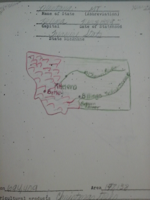
This is a page from a booklet I did in the fifth grade with profiles of each of the 50 states! However, since that booklet was based on 1983 data (or older), I will be attempting to “update” each one of these entries, and show the 1983 population versus the population of today! I also plan to include a list of the most populous cities in each state, and whatever other information I feel like putting in there! Yes…you will see a hand-drawn map of each U.S. state! I got an “A-minus” on the whole project, if inquiring minds want to know! Also, Montana’s population estimate now is 1,050,493…